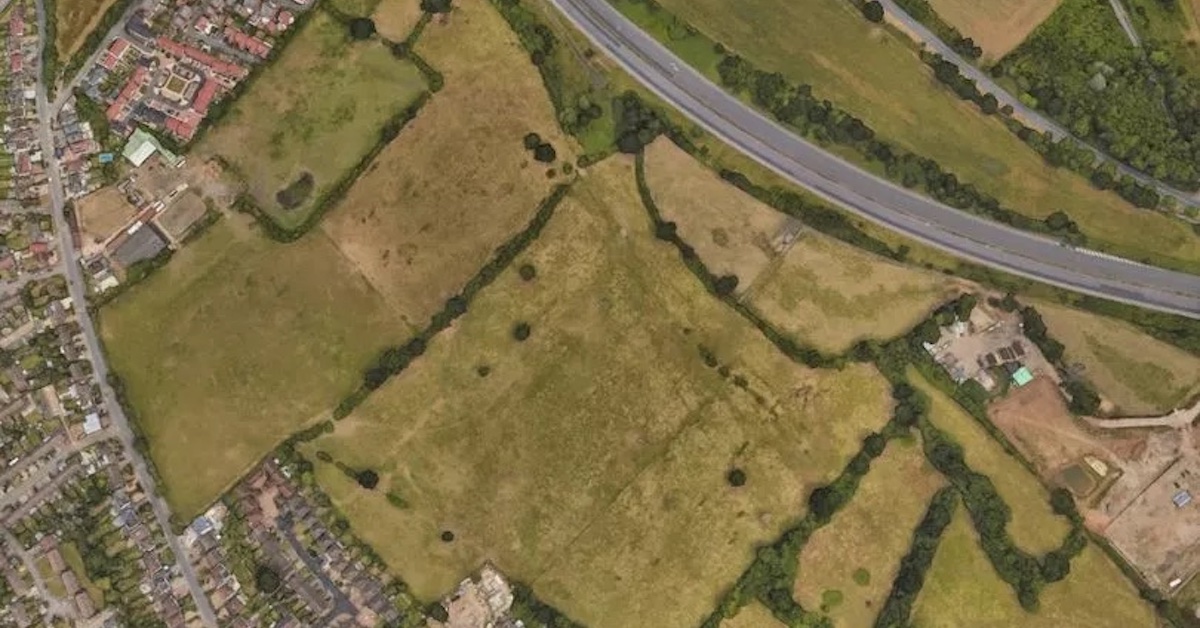
Redrow Homes cannot build up to 310 in green belt between Bushey and the M1, a planning inspector has ruled.
Planning inspector Joanna Gilbert said Harts Farm planners failed to “recognise the intrinsic character and beauty of the countryside” in their application.
Around eight per cent of the development site, on the bank of the Bushey Heath Drain, lies in flood zone two, with 4.81 per cent in the highest risk flood zone three area.
The inspector said the developer’s flooding assessment had a limited “granularity”, highlighting Environment Agency evidence of surface water flow paths on the site and ruling that planners should have considered other nearby sites to accommodate new homes where there is a lower flood risk.
Hertsmere Borough Council originally failed to rule on the application in time, which prompted a national-level appeal with the Planning Inspectorate.
During the proceedings, Redrow Homes’ lawyers accused the authority of keeping “its head buried firmly in the sand” for decades.
Barristers Zack Simons and Isabella Buono, on behalf of Redrow, said the site is a “highly sustainable location” and is “not a valued landscape” without designations locally, regionally or nationally. But in a July ruling, the inspector wrote: “The site consists of overgrazed fields with hedgerows and trees in varying condition.
“There has been some loss of hedgerow and introduction of fencing. While open pasture grassland … is a positive feature, the ongoing degradation of the fields is unfortunate, but does not diminish their inherent value. Despite the degradation and their relative lack of rarity, the fields have a strong sense of place.”
Ms Gilbert said although the developer argued the condition of the fields means building would be less disruptive, she felt there are a range of other factors which mean new homes would have a “significant harmful effect” on the area’s character and appearance.
She said existing buildings already have an “urbanising effect” and that the area is fragmented by the M1 and A41 road corridor.
Turning to flooding, the inspector’s ruling notes most of the site has a low flood risk – in flood zone one. But Ms Gilbert said “consideration needs to be given to all sources of flood risk affecting the site”. She explained: “An area of medium and high surface water risk lies along the field boundary across the centre of the site.
“Additional potential surface water flow paths at low and limited areas of medium flood risk are indicated in the site’s south-west and north-west areas. This mapping does not account for the impact of climate change. Surface water flooding on the site could occur as a result of overland surface water flow paths and from the site’s own surface water run-off.”
The inspector pointed to national planning rules which set out planners should apply a “sequential test” which takes into account flood risk and climate change. “The aim of the sequential test is to steer development to areas with the lowest risk of flooding,” the national rules read.
“Development should not be allocated or permitted if there are reasonably available sites appropriate for the proposed development in areas with a lower risk of flooding.”
Ms Gilbert said taking into account evidence from Redrow, Hertsmere Borough Council and Hertfordshire County Council, she found “some 13 sites” which could be considered “reasonably available”.
In their opening statement, Mr Simons and Ms Buono said: “This part of Hertfordshire has been let down by the planning system. Years go by, decades pass, national policies come and go, but through it all, this council has managed to keep its head buried firmly in the sand. For too long, Hertsmere has been frozen in aspic.”
Hertsmere’s “core” set of planning policies are 10 years old, dating back to 2013. They added: “This is a highly sustainable location sandwiched between the built-up area of Bushey and the M1.” They noted there were no objections from authorities related to highways, heritage, air quality, ecology, trees or design.
Emmaline Lambert, barrister on behalf of Hertsmere Borough Council, said “there are benefits but these are overplayed” and pointed to a submission from the county council – the flood authority – objecting to the scheme. The inspector ruled planning permission should be refused because “despite the development’s merits, the very special circumstances do not outweigh” conflicts with local and national policies.
Reacting to the decision, Councillor Nik Oakley (Lab, Borehamwood Kenilworth), who is responsible for planning in Hertsmere, said: “The five-year-long campaign has been worth it to protect this rural piece of Bushey where animals have grazed for centuries. The Little Bushey Community is delighted with the outcome of the planning appeal which reinforces our belief that the development would be harmful to the green belt and impact on flooding. The decision is lengthy and complex and we are waiting for Hertsmere planning officers to analyse the decision.”
© Eastern Echo (powered by ukpropertyforums.com).
Sign up to receive our weekly free journal, The Forum here.


